




Surrounded by green mountains and cool pine forests, Kalaw has long been regarded as one of Myanmar’s most picturesque hill stations. Nestled 4,250 feet above sea level, the historic town has offered residents and travelers alike a welcome retreat, particularly during the rainy season.
Today, however, the monsoon brings a pervasive sense of anxiety.
That fear stems from September 2024, when Kalaw experienced the worst flood in its century-long history. Floodwaters, reaching depths of 15 to 20 feet, inundated Wards (2), (3), and (4) in the heart of the town, destroying hundreds of homes and leaving residents fearful of every heavy downpour.
“Whenever it rains heavily for a prolonged period, we have to start packing our bags,” said Ko Phone Kyaw, a 40-year-old resident of Ward (3) who lives near Kalaw Creek.
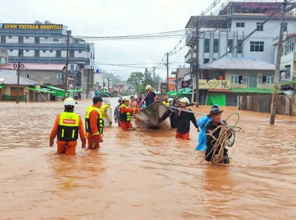
Kalaw Creek runs south to north through the center of the town. Stretching more than 30 miles, it is formed by the confluence of the Taunglar, Thit Hla, and Myin Taik creeks, which originate south of Pyin Thar Village in Taunglar Village Tract. The waterway eventually flows underground near Ngoke Village before emptying into Inle Lake.
Following the 2024 disaster, local authorities widened sections of the creek bed. However, experts warn that the measure addresses only part of the problem.
A local geologist who compiled a comprehensive study of Kalaw Creek and surrounding landslide-prone areas said engineering works alone would not prevent future disasters.
“Simply widening the creek isn’t enough. We need to understand how to live with a changing climate and determine what measures are needed,” the geologist said.
The study recommends a comprehensive Stream Course and Catchment Area Analysis that integrates meteorological and hydrological data. It also proposes a master plan for flood and landslide mitigation, outlining short-, medium-, and long-term strategies, along with strict land-use zoning for urban, rural, agricultural, and forest areas. The findings have been submitted to local authorities and environmental conservation groups.
Ko Phone Kyaw, who works in the tourism sector, believes Kalaw can harness its tourism industry to support environmental restoration. He noted that many visitors come specifically to trek through the area’s forests and villages.
“For tourists arriving at the beginning of the monsoon season, we can encourage them to plant trees along their trekking routes,” he said. “If they want to donate money to help maintain the trees they plant, we can accept the funds and track each tree using digital maps as a keepsake. Visitors who come during the winter or summer can help care for trees planted earlier. Even those who cannot travel here can contribute funds to have trees planted on their behalf.”
A 60-year-old local historian said that when Kalaw was established more than a century ago, authorities enforced strict environmental safeguards, including the construction of water-retention reservoirs and bans on building along creek banks.
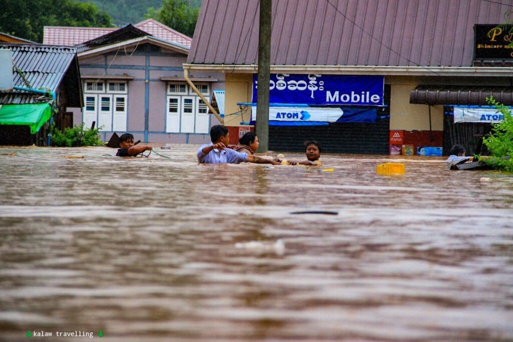
“Creek flooding has been an issue since the town was founded. But now the creek banks and former reservoir sites have been turned into residential wards and government offices. Because we failed to protect the forests, flooding has only become worse. Everyone has to work together to fix this,” the historian said.
Hotelier Tun Tun Win said the 2024 flood dealt a severe blow to Kalaw’s tourism industry. Visitor numbers fell sharply and have yet to fully recover.
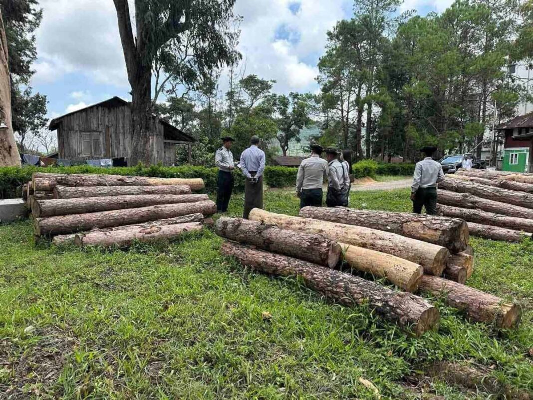
He added that environmental degradation has been driven not only by unregulated housing expansion but also by developers clearing local pine forests to supply timber for new buildings and interior furnishings.
A member of the Pyithu Hluttaw (House of Representatives) representing Kalaw said authorities are negotiating to reclaim community forests that have been occupied without authorization under existing laws, while also clearing encroachments along the creek and railway corridors.
However, young resident Ko Zaw Zaw Win said illegal logging has severely degraded critical watersheds over the past five years, particularly in the Yae Aye Kan Reserved Forest—the primary watershed feeding Kalaw Creek—as well as surrounding pine forests.
“Owners of community forestry plots have been secretly cutting down trees,” he said. “Loggers target the largest trees, fell them, and immediately cut them into planks with chainsaws. It’s not that entire forests disappear overnight, but thousands of trees have certainly been lost. We’ll need to conduct another forest survey to know the true extent of the damage.”
According to sources close to the Forestry Department, 30-year community forestry permits were issued during former President Thein Sein’s administration in 2010 to help combat deforestation.
The program established more than 10,000 acres of community forests, including 6,809 acres around Kalaw and another 2,400 acres in nearby villages. Local observers say that unless these protected forests are effectively safeguarded, long-term flood mitigation efforts will remain impossible.
Youth activist Ko Aung Kyaw Min Soe said local young people previously organized tree-planting campaigns in the Yae Aye Kan Reserved Forest and on Taung Min Gyi Mountain, but those efforts have stalled over the past five years.
“We talked about restarting tree-planting this monsoon season,” he said. “But because the political situation remains so uncertain, we decided to wait and see, and nothing happened. The monsoon season is too short now, so we missed our chance this year. Maybe next year.”
He added that many young residents remain ready to resume environmental conservation efforts once conditions improve.
Despite the political uncertainty and mounting environmental challenges, residents point to one encouraging sign: the once-constant roar of chainsaws illegally felling trees in the surrounding hills has gradually begun to fade, offering a fragile but meaningful glimmer of hope for Kalaw’s future.





Leave a Comments